


Public Story
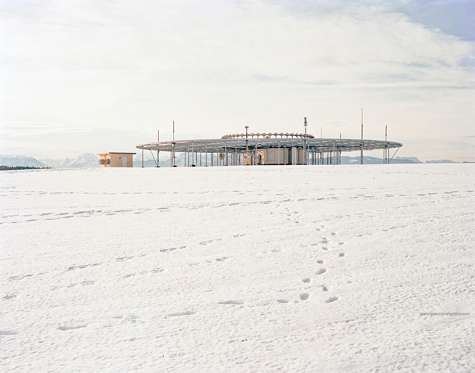
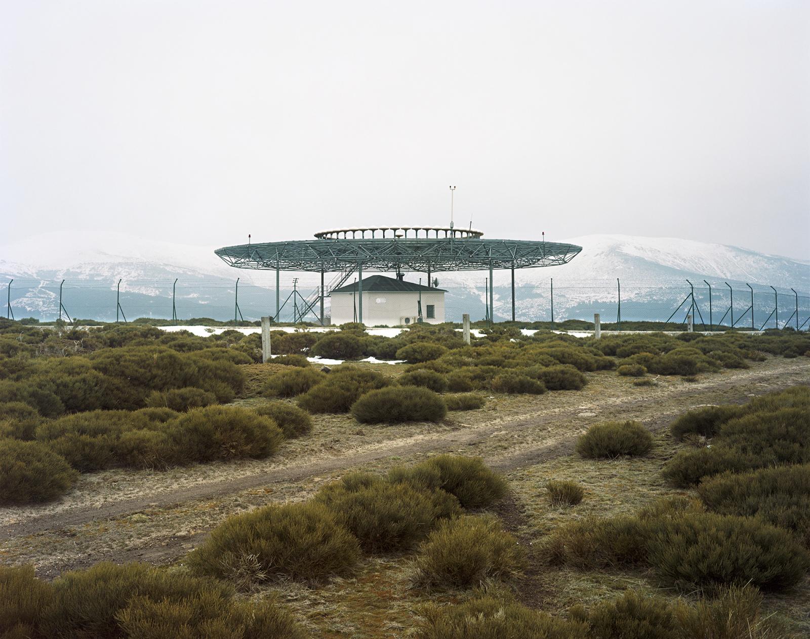
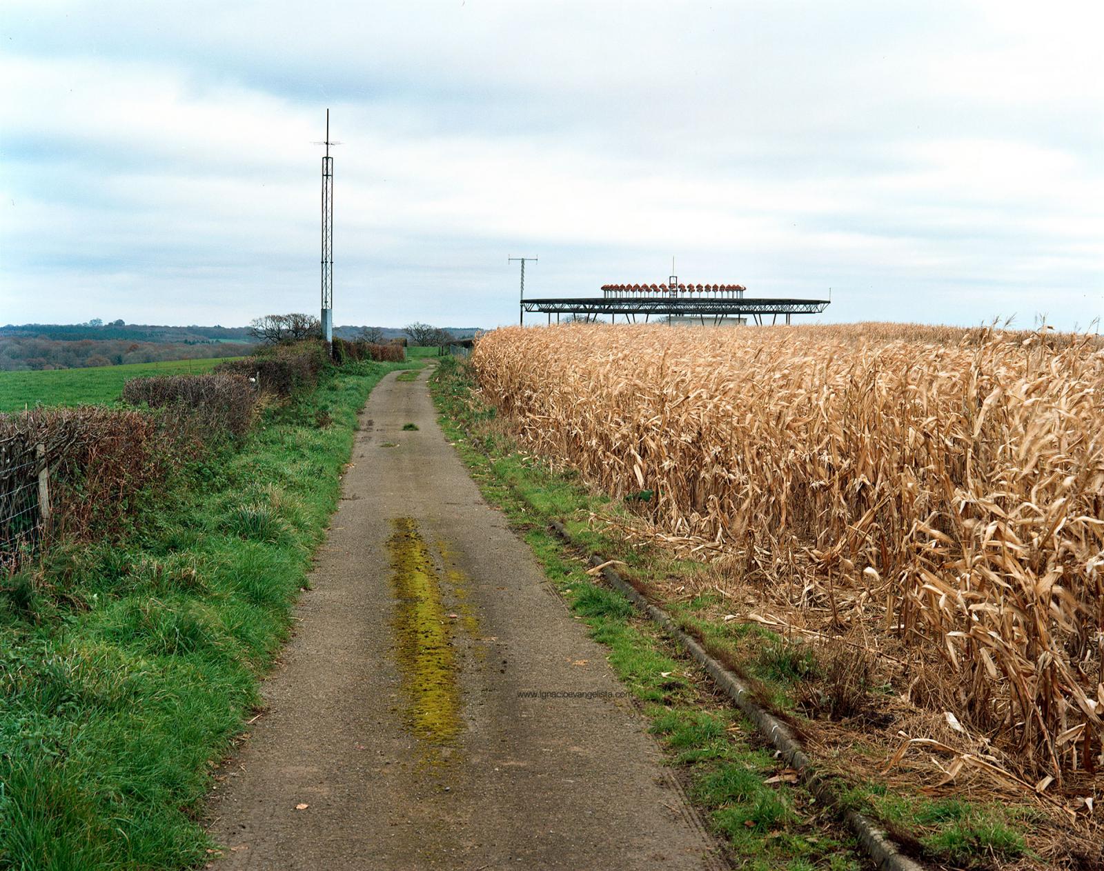
VOR: Before the Satellite
In this project, I am portraying some of the VOR stations through which an imaginary air route would pass, connecting some of the major European airports.
1,580

