
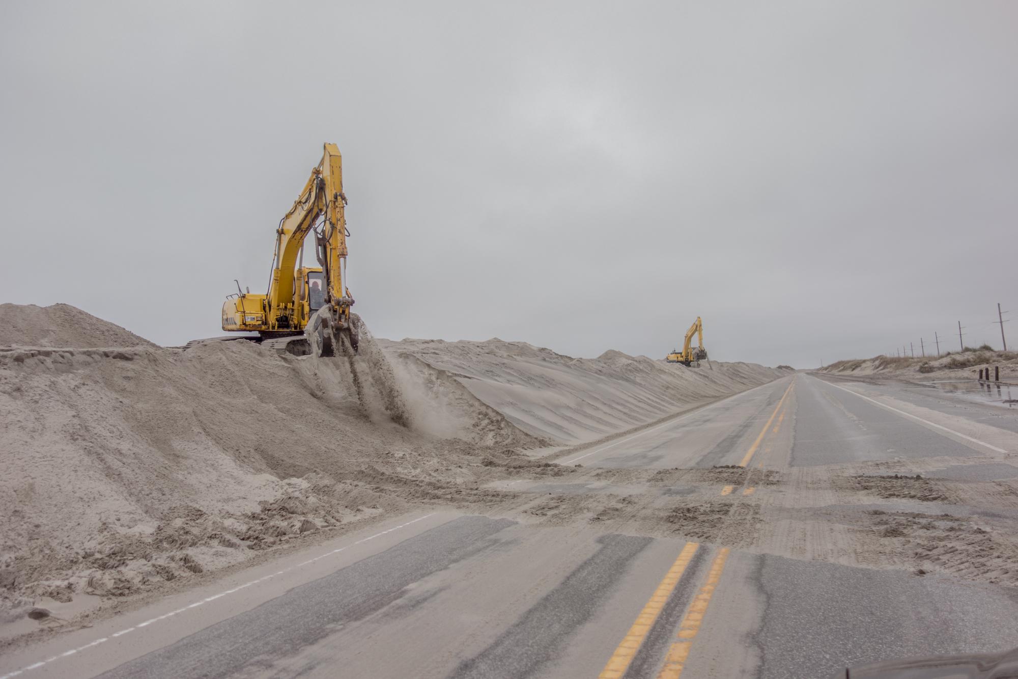
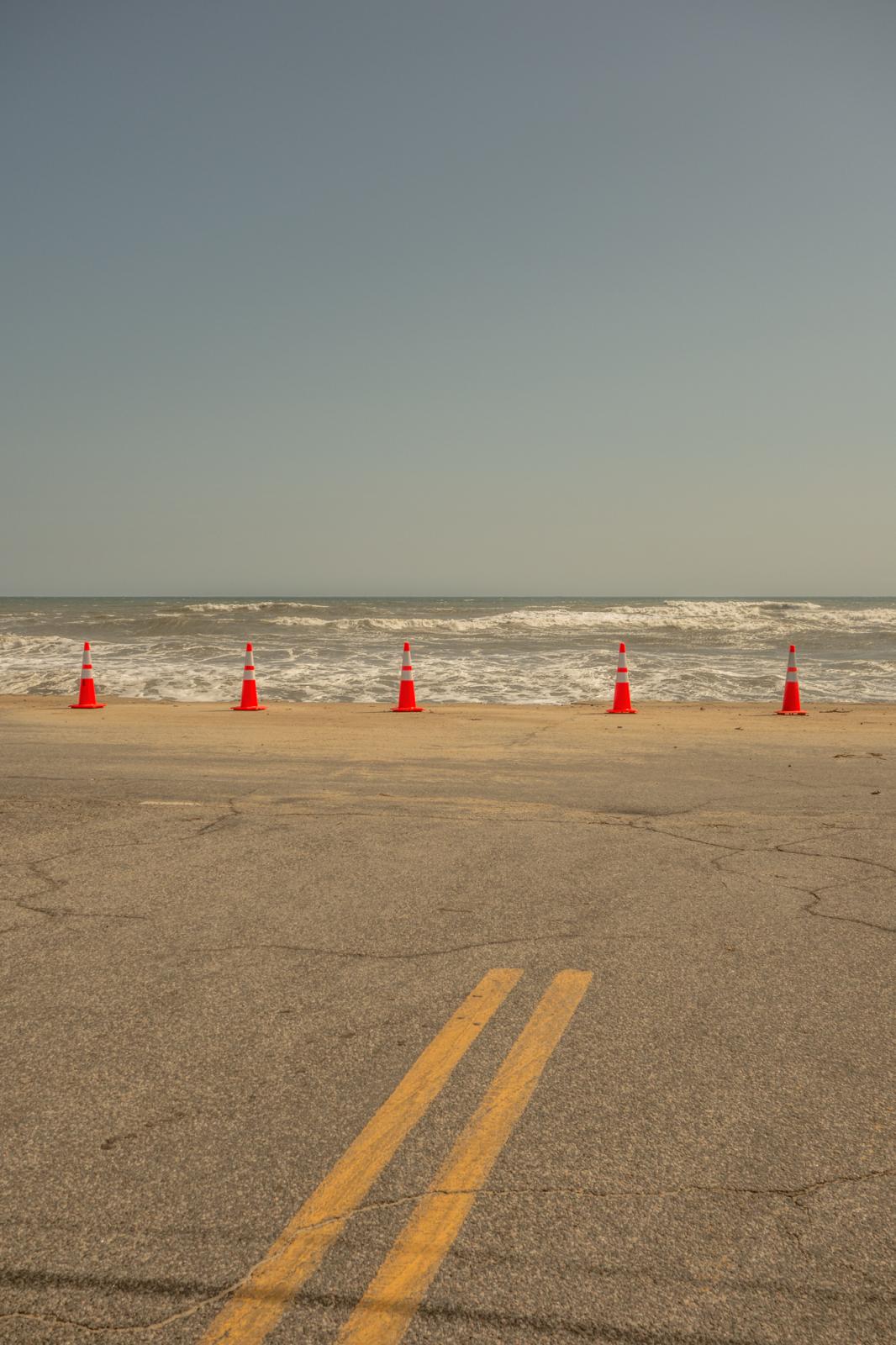
Windblown sand and over-wash along NC-12 on Cape Hatteras National Seashore is responsible for road closures and continual maintenance from the North Carolina Department of Transportation. As a vital north-to-south artery, the highway connects the island communities from Corolla to southern points of Cape Hatteras. However, as the land narrows, towns and taxpayers have increasingly paid for road maintenance or full rebuilds as a result of the road washing away. In Kitty Hawk, this same section of road collapsed twice within a few months in 2015, prompting construction of sandbags skirting the shoreline for over 1000 feet. For this stretch of NC-12 between Oregon Inlet and Ocracoke Village, maintenance and repairs have well exceeded $104 million.
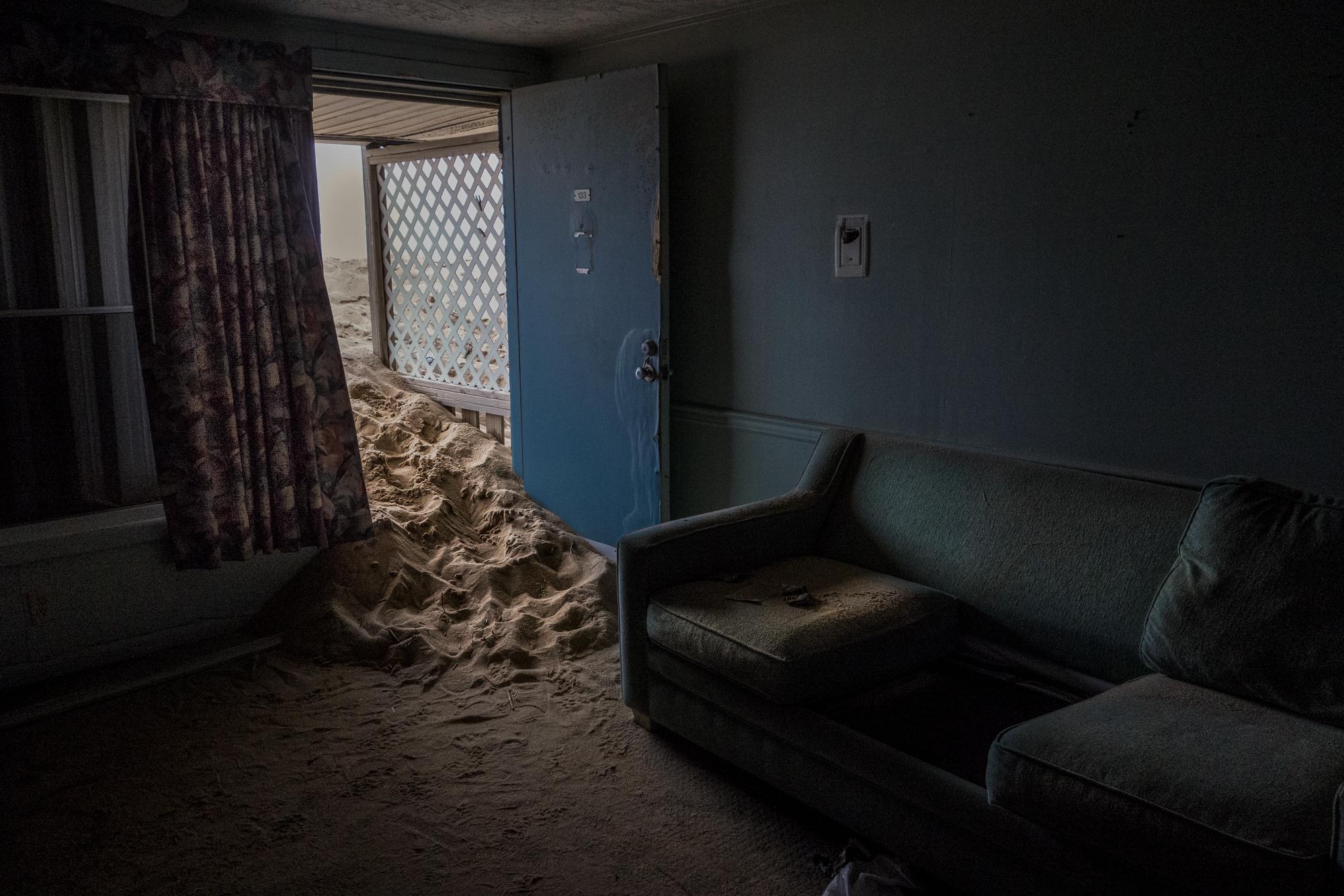
Sand encroaches into a room of the now demolished Beacon Motor Lodge in Nags Head, North Carolina. Oceanfront motels like the Beacon Motor Lodge, built in 1969, once dotted the landscape catering to area visitors but have found competition in the vacation rental by owner economy with new, less expensive properties being built. Such properties account for hosting the majority of vacationers on the Outer Banks as hotels and motels have lost business and closed their doors over the years.
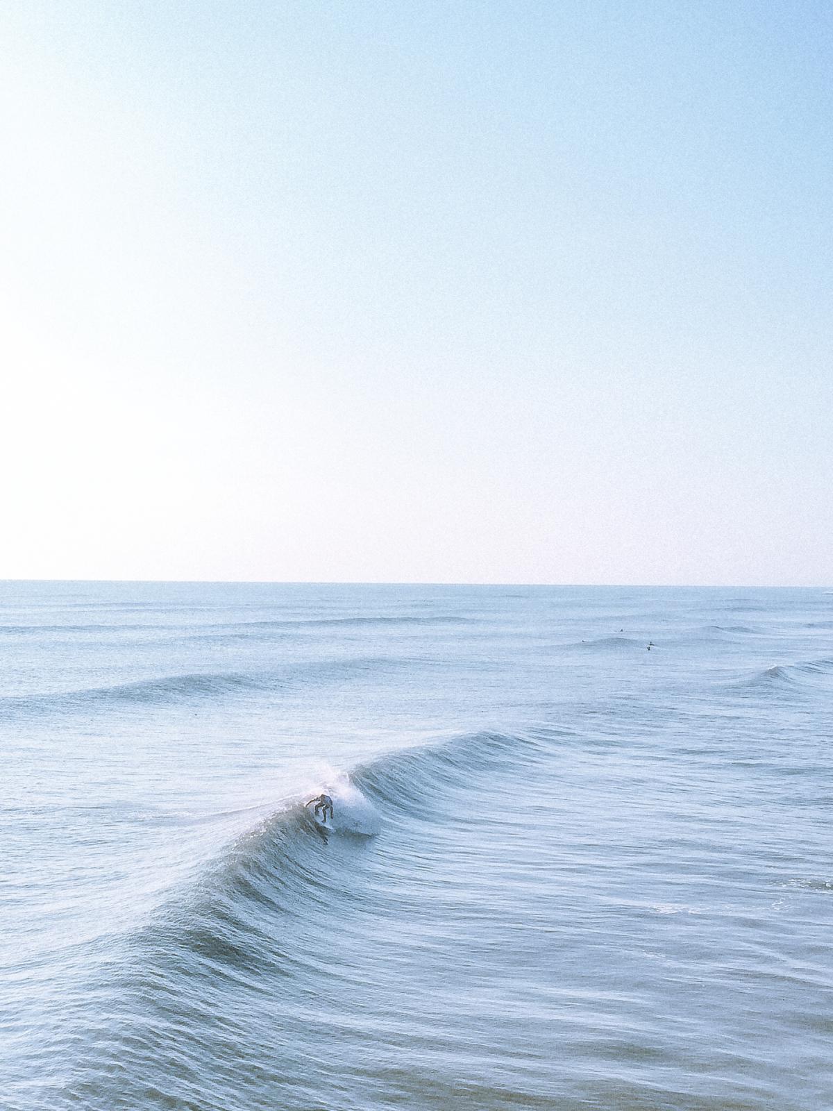
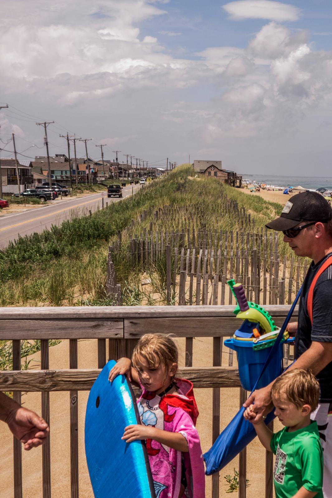
The Outer Banks is a popular surfing destination on the East Coast known for steep faces and wind-blown conditions. The string of barrier islands along North Carolina’s coast brings in nearly $1 billion a year through tourism-related spending, the bulk of the season lasting just four months, from June through September.

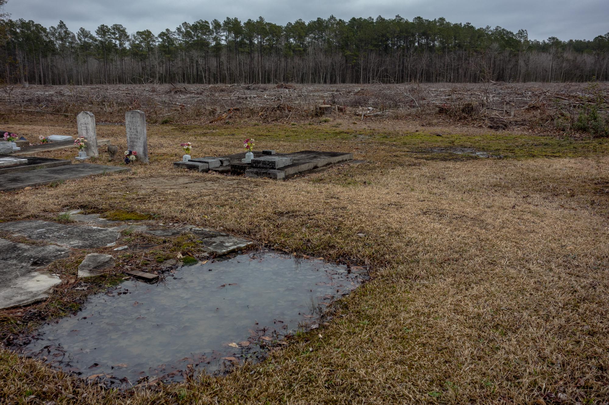
Each year, the small fishing community of Stumpy Point hosts an oyster feast for residents and visitors. Along the Pamlico Sound and bordering the Alligator River National Wildlife Refuge, around 243 people call Stumpy Point their home. Surrounded by wetlands, swamps and maritime forest, Stumpy Point is an inland fishing community protected by the presence of the Outer Banks barrier islands. The surrounding habitat is host to several endangered species and a thriving habitat threatened by encroaching salt water.
It took years for a string of condemned homes in Nags Head to be removed from the landscape after being overcome by an eroding shoreline. Dare County, which includes the majority of the barrier islands, is the only county in North Carolina to have nearly an equivalent number of people as there are housing structures. At 35,000 residents (U.S. Census 2010), there are 34,000 housing units. However, according to a study by the Carolina Population Center at UNC, "44% of Dare's housing units were seasonal housing." For locals and natives who call this their home, the seasonal housing market and limited land affects affordable housing issues for residents.

Windblown sand and over-wash along NC-12 on Cape Hatteras National Seashore is responsible for road closures and continual maintenance from the North Carolina Department of Transportation. As a vital north-to-south artery, the highway connects the island communities from Corolla to southern points of Cape Hatteras. However, as the land narrows, towns and taxpayers have increasingly paid for road maintenance or full rebuilds as a result of the road washing away. In Kitty Hawk, this same section of road collapsed twice within a few months in 2015, prompting construction of sandbags skirting the shoreline for over 1000 feet under constructed dunes. For this stretch of NC-12 between Oregon Inlet and Ocracoke Village, maintenance and repairs have well exceeded $104 million.
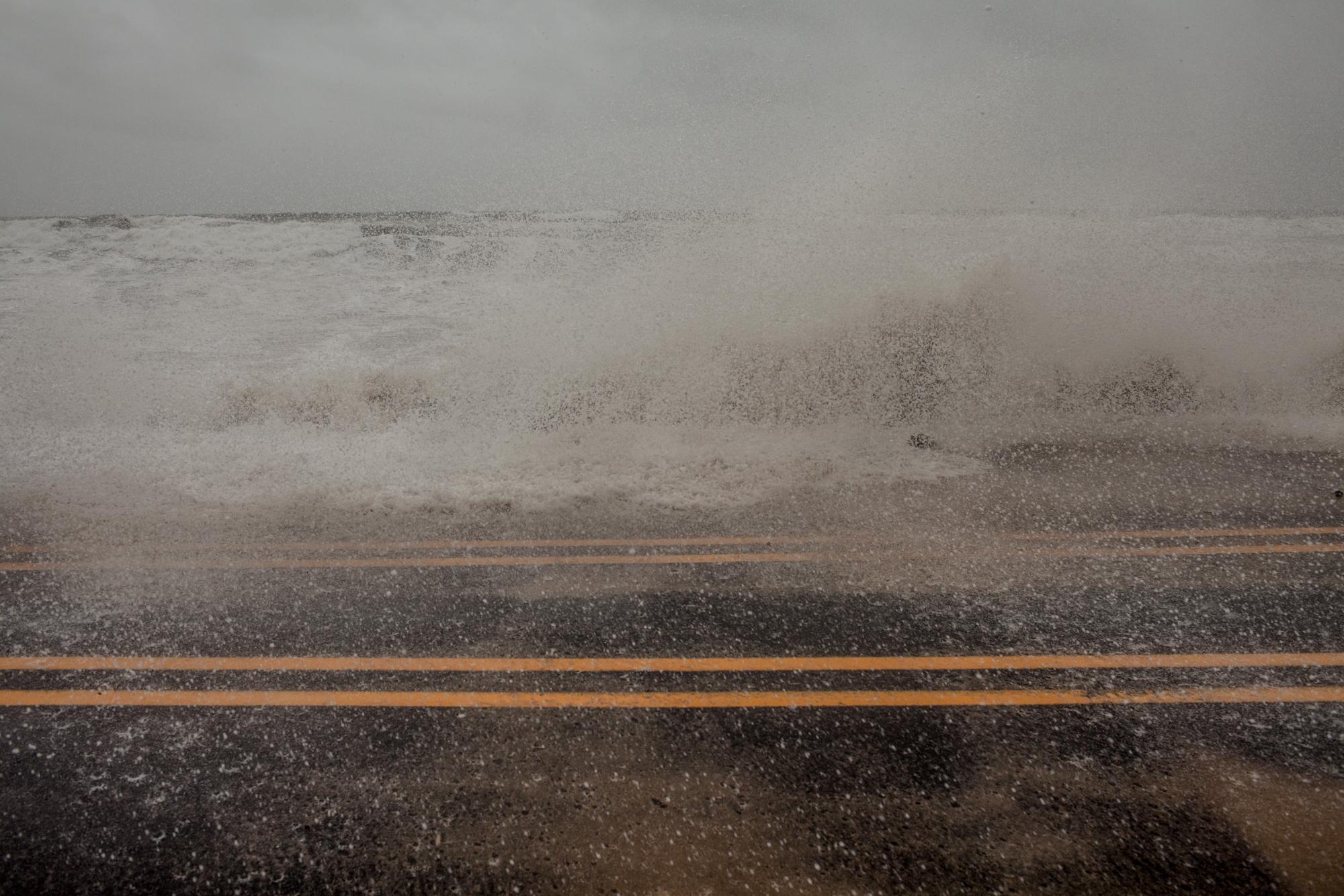
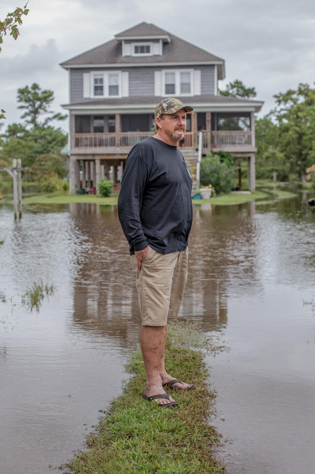
Despite Hurricane Joaquin moving further offshore than initially predicted, sparing most of the Outer Banks from heavy damage, a stalled cold front produced heavy rains, coastal flooding and high winds along the coast. Over-wash along sections of NC-12 in Kitty Hawk is a norm, responsible for road closures and continual maintenance from the North Carolina Department of Transportation. As a vital north-to-south artery, the highway connects the islands from Corolla to southern points of Cape Hatteras. However, as the land narrows, towns and taxpayers have increasingly paid for maintenance or full repairs as a result of the road washing away. In Kitty Hawk, this same section of road collapsed twice within a few months in 2015, prompting construction of sandbags skirting the shoreline for over 1000 feet.
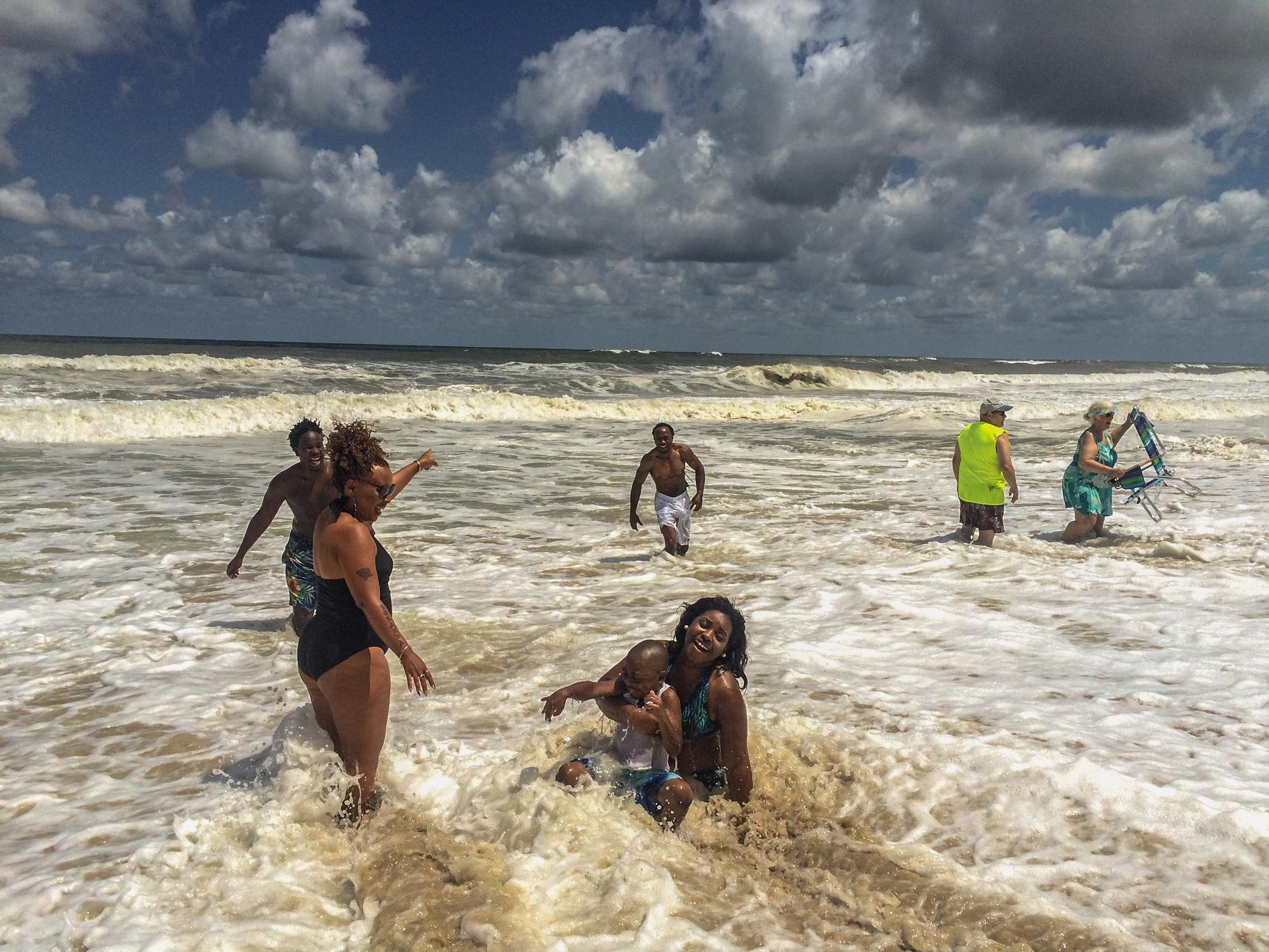
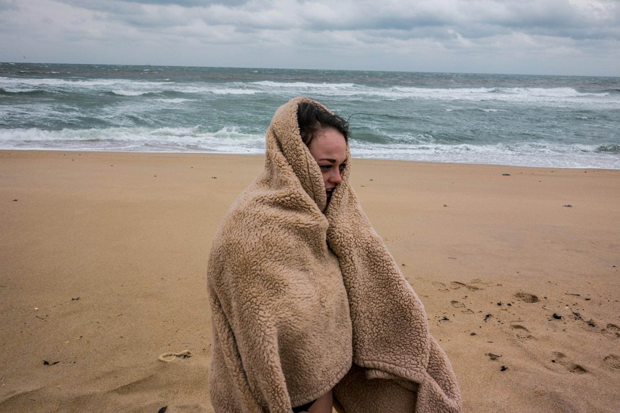
A storming Atlantic Ocean attracts both residents and visitors as people surveyed what remained of Hurricane Joaquin after the system moved offshore.
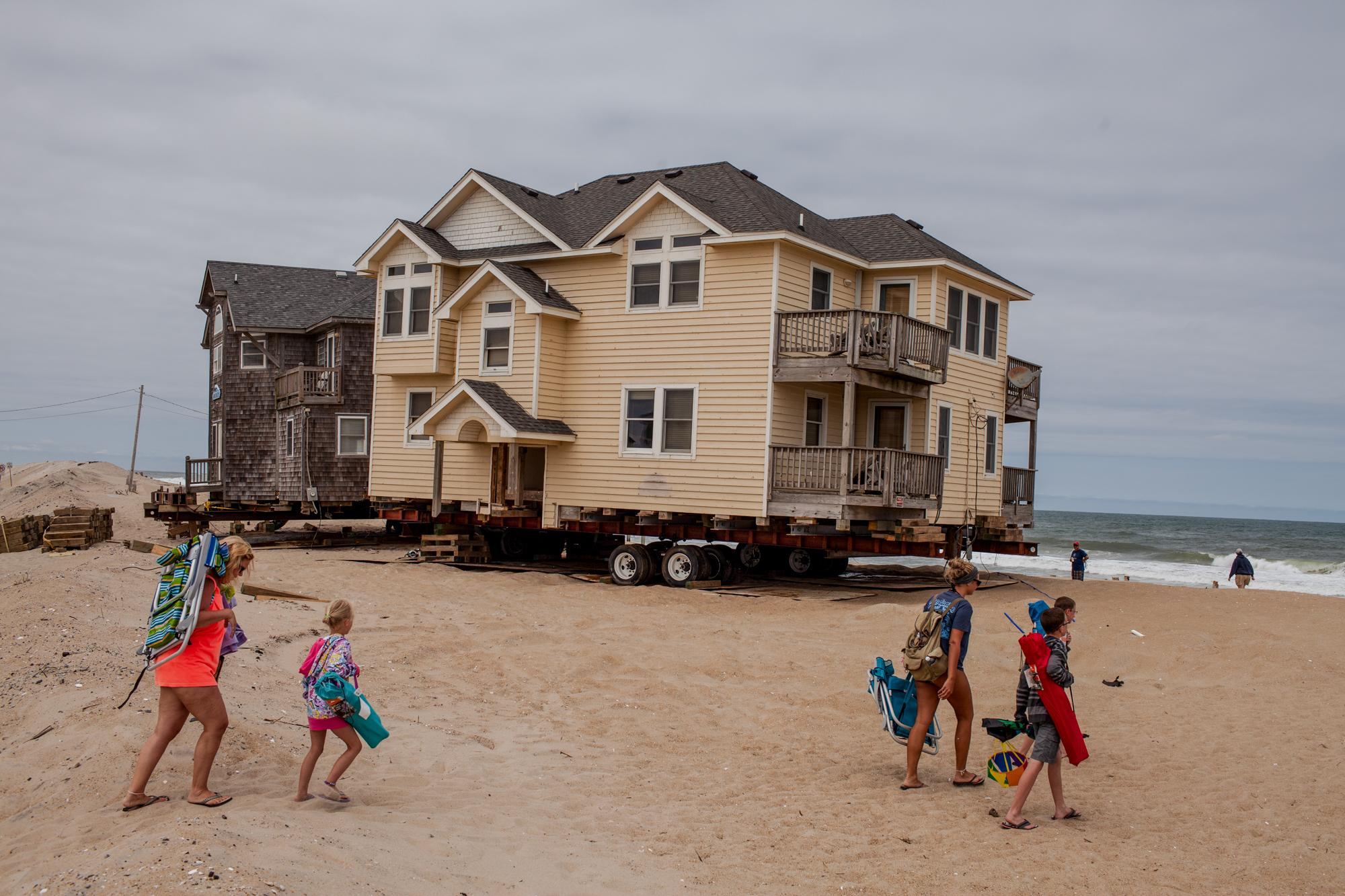
A family walks to the beach across what was once ocean-front property to several Rodanthe, North Carolina homes. Under threat of continual storms, erosion and rising sea levels, homes along the coast of the Outer Banks are being relocated further from shore while other towns, such as Nags Head just to the north, spends millions on beach renourishment projects extending the shoreline back into the Atlantic.
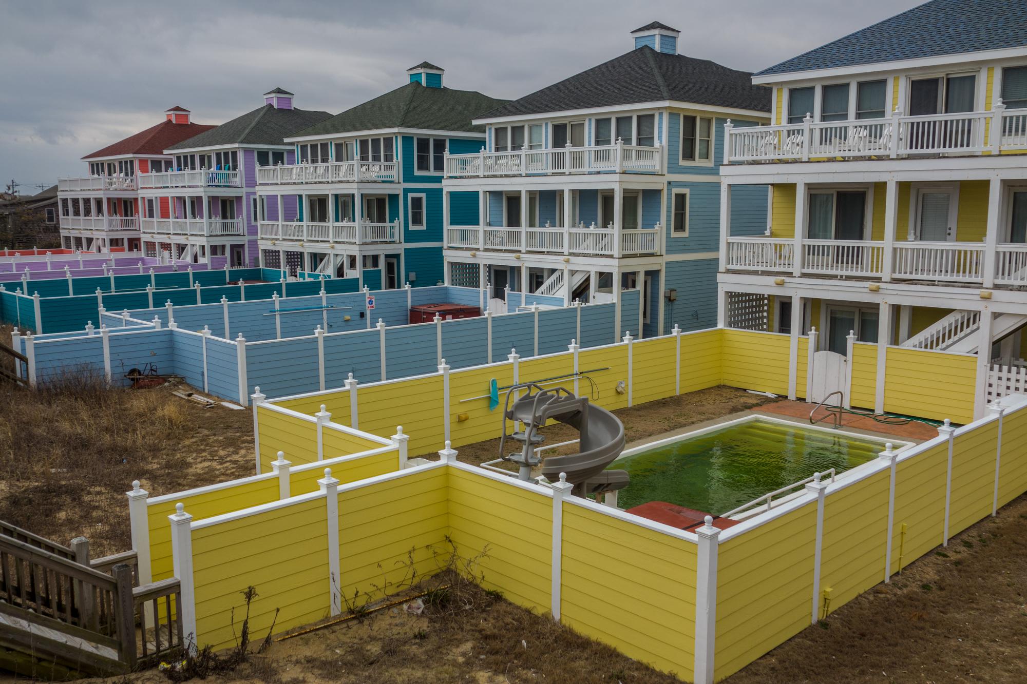
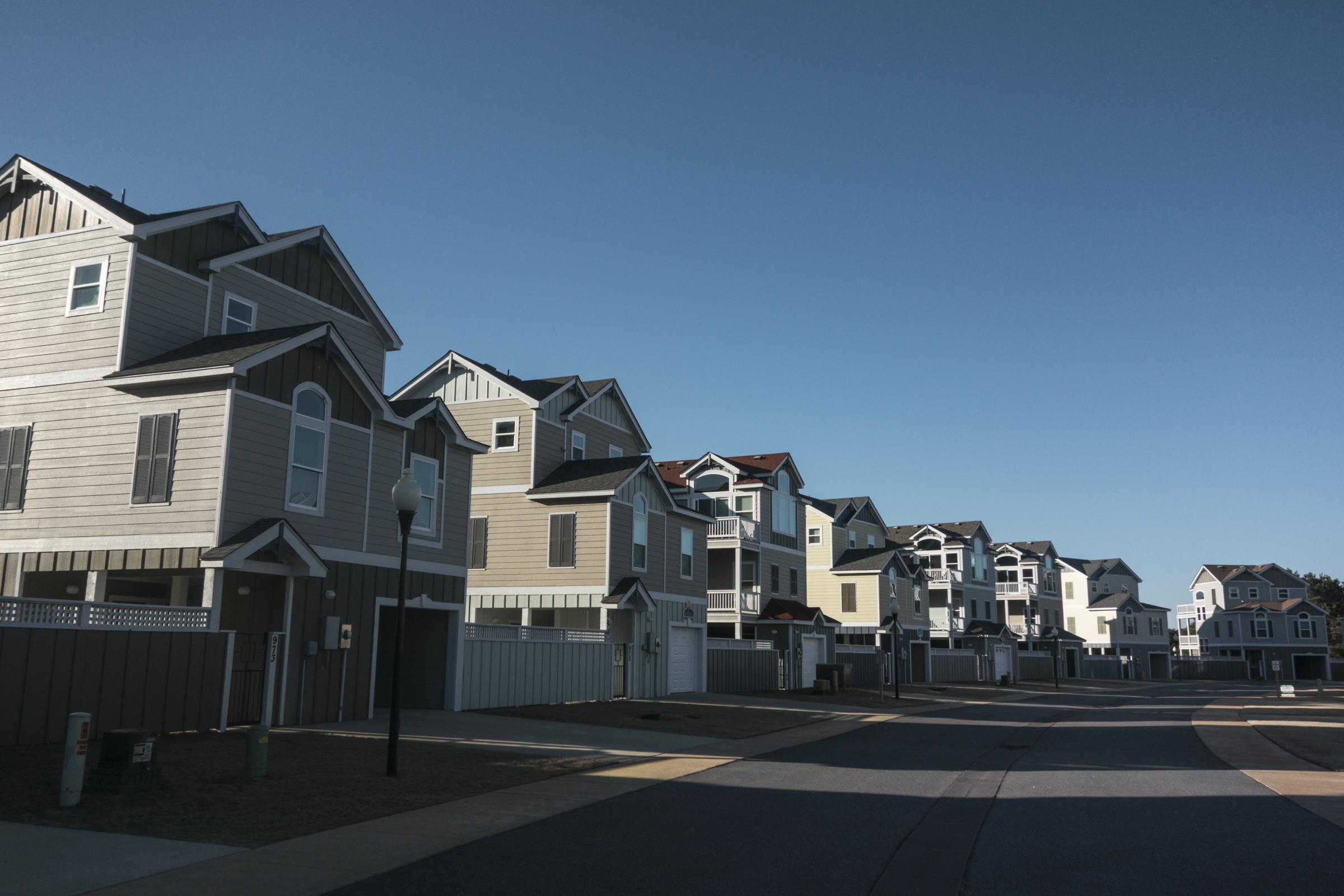
As homes further south are being relocated from encroaching seas and threats of an eroding shoreline, new properties catering to vacation rental by owner investors are continually constructed, especially further north in Corolla. Many vacation properties are rented on a weekly basis for upwards of $20,000 per week during peak season and are often vacant for months during the off-season. The string of barrier islands along North Carolina’s coast brings in nearly $1 billion a year through tourism-related spending, the bulk of the season lasting just four months, from June through September. A development boom beginning after WWII led to increased buildings to accommodate an influx of residents and visitors between Currituck County, which includes Corolla to the north, and Dare County to the south. Dare County, which includes the majority of the barrier islands, is the only county in North Carolina to have nearly an equivalent number of people as there are housing structures. At 35,000 residents (U.S. Census 2010), there are 34,000 housing units. However, according to a study by the Carolina Population Center at UNC, "44% of Dare's housing units were seasonal housing." For locals and natives who call this their home, the seasonal housing market and limited land affects affordable housing issues for residents.
The Outer Banks is a string of barrier islands along North Carolina’s coast which brings in nearly $1 billion a year through tourism-related spending, the bulk of the season lasting just four months, from June through September. A development boom beginning after WWII led to increased buildings to accommodate an influx of visitors. Dare County, which includes the majority of the barrier islands, is the only county in North Carolina to have nearly an equivalent number of people as there are housing structures. At 35,000 residents (U.S. Census 2010), there are 34,000 housing units. However, according to a study by the Carolina Population Center at UNC, "44% of Dare's housing units were seasonal housing." For locals and natives who call this their home, the seasonal housing market, and limited land causes increased demand with low supply. As the world braces for sea level rise, this stretch of sand is and its residents are well into an infinite battle with nature. What would otherwise be a natural adaptation to rising sea levels, the presence of man-made structures like buildings and roads prevent this natural migration, and exacerbate the problem. The result is increased shoreline erosion, forest retreat, and short-sighted spending. According to a study of developed shoreline from Western Carolina University, North Carolina has spent $640.4 million since 1990 on beach nourishment projects.
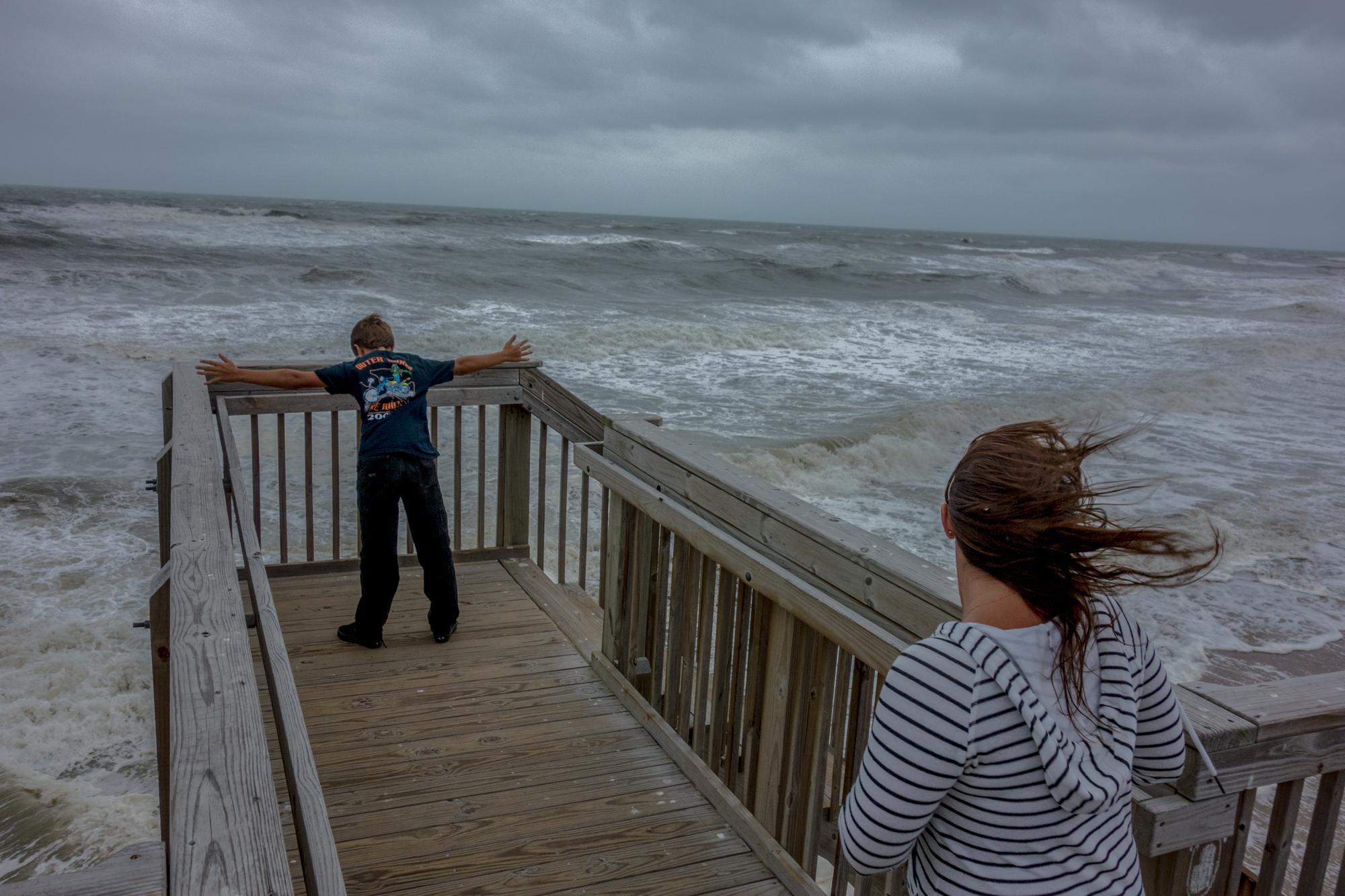
A storming Atlantic Ocean often attracts both residents and visitors to the shore in anticipation of what's to come.
What would otherwise be a natural adaptation to rising sea levels, the presence of man-made structures like buildings and roads prevent the natural migration of barrier islands and exacerbate the problem. For places like the Outer Banks which naturally migrate from the east to west, the result is increased shoreline erosion, forest retreat, and continual use of financial resources. According to a study of developed shoreline from Western Carolina University, North Carolina has spent $640.4 million since 1990 on beach nourishment projects.
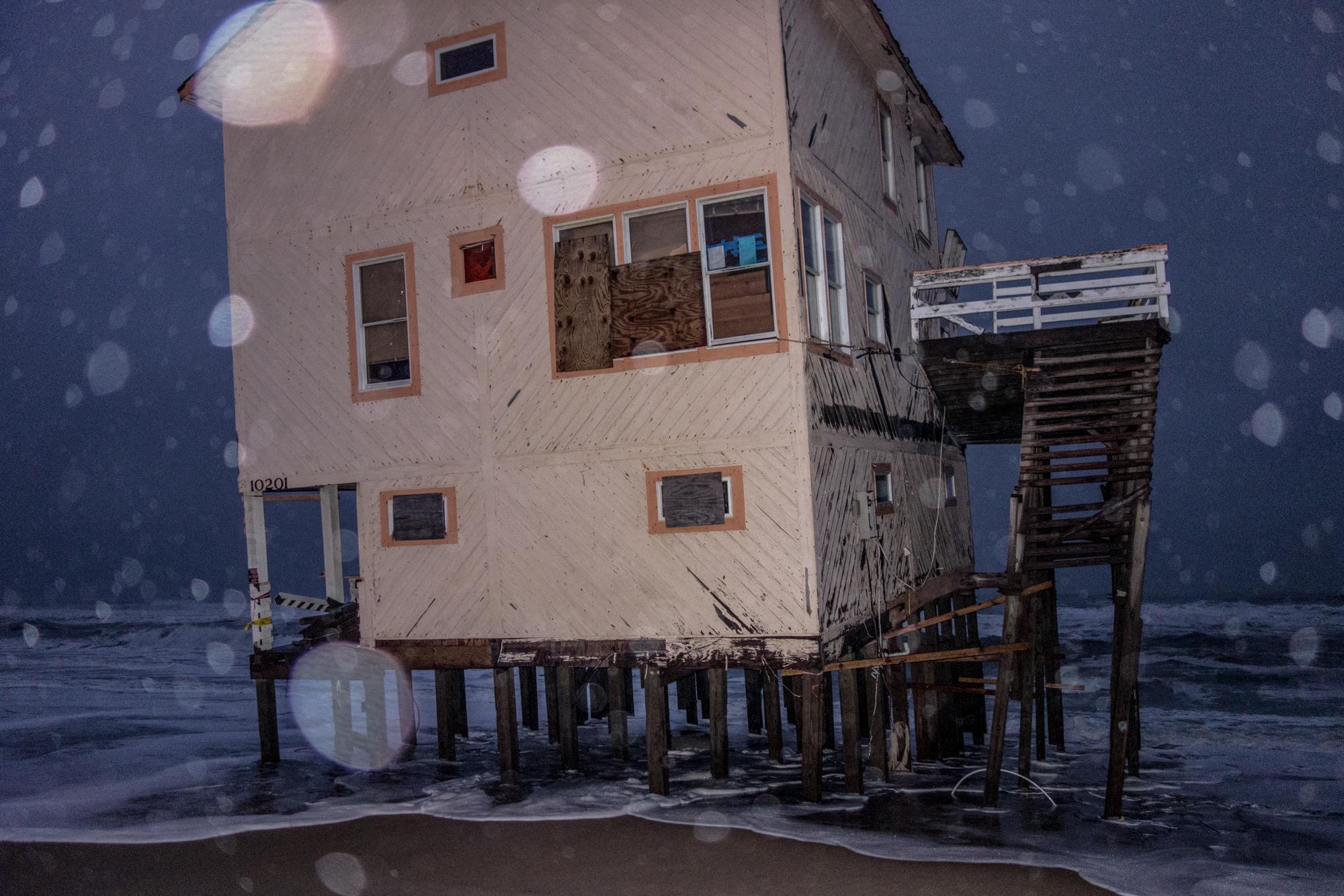
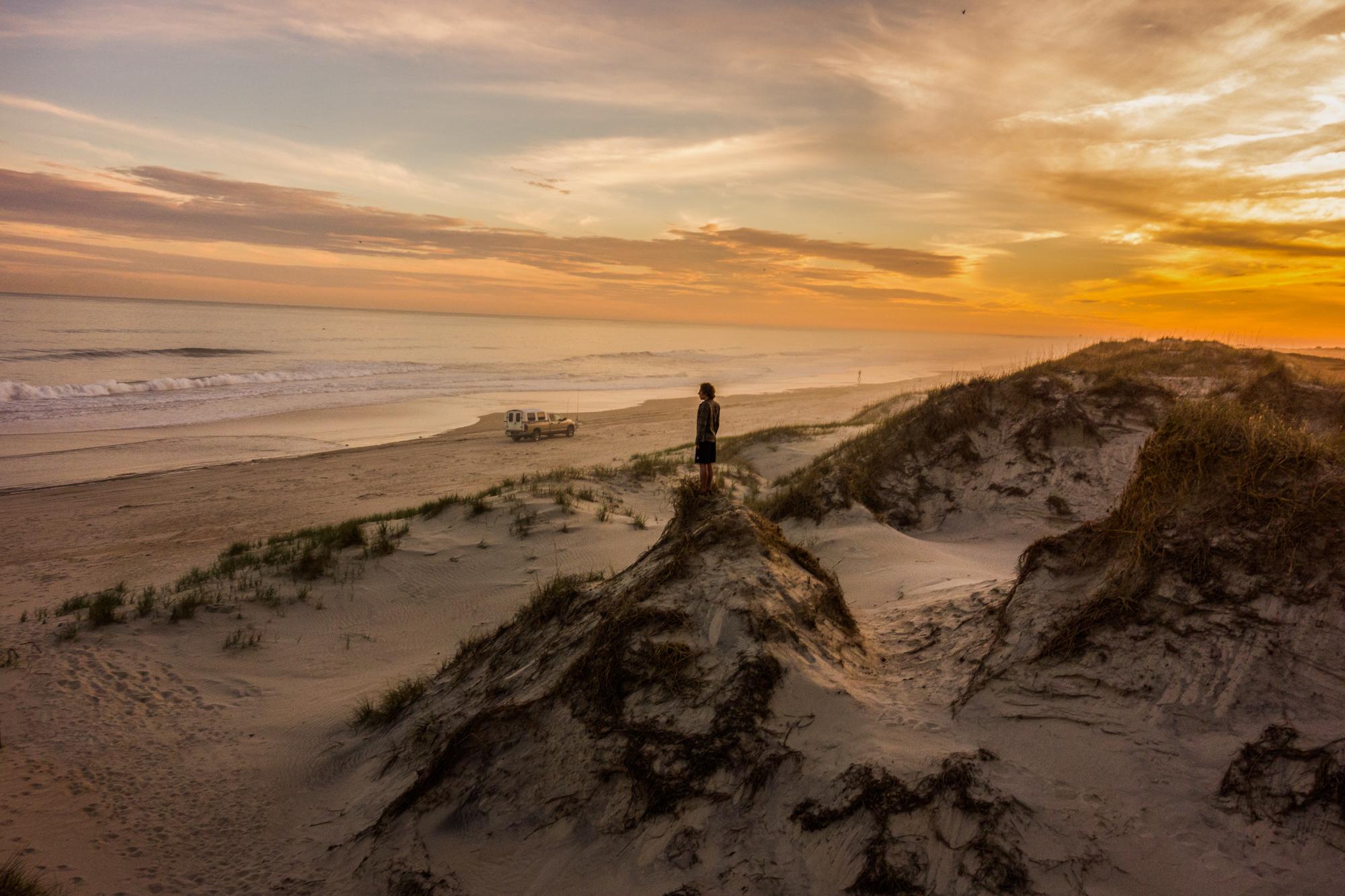
Visitors leave the beach one summer afternoon, crossing over a sand dune set up to protect nearby communities from the Atlantic Ocean. What would otherwise be a natural adaptation to rising sea levels, the presence of man-made structures like buildings and roads prevent thenatural migration of barrier islands like the Outer Banks. According to a study of developed shoreline from Western Carolina University, North Carolina has spent $640.4 million since 1990 on beach nourishment projects. When the Cape Hatteras Lighthouse was built in 1870 on the coast known as the Graveyard of the Atlantic, its home was 1,500 feet from the shoreline. By 1999, the lighthouse was relocated after only 120 feet of shore remained between its location and the Atlantic. Four towns recently spent around a collective $41.7 million on a renourishment project in 2017. Nags Head is spending $42.7 million for an upcoming beach renourishment project being funded through FEMA, a loan paid back by property owners, the town’s capital reserve fund, as well as the Dare County Beach Nourishment Fund after Hurricane Matthew caused a loss to a third of the sand from a previous nourishment project in 2011.
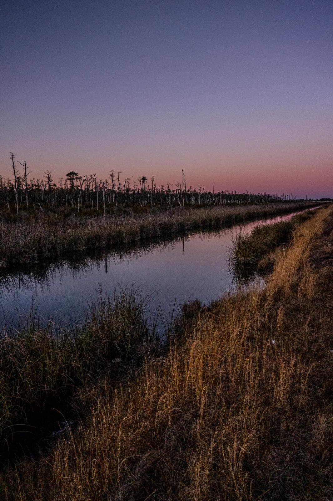
In areas just west of the Outer Banks like the Alligator River National Wildlife Refuge, ghost forests are signs of the effects of an unstable habitat where the freshwater marshes are rapidly turning brackish and eventually to complete salt water. These coastal forests are not only important habitats for wildlife, they also act as buffers from storms, protecting interior communities from storm surges.
Elevated not much higher than sea level, inland communities just west of the Outer Banks are protected by barrier islands such as the Outer Banks. As sea level rises and coastal forests are inundated with salt water, ghosts forests form and not only affect the surrounding habitat, but also diminish their role as buffers from storms and storm surges.
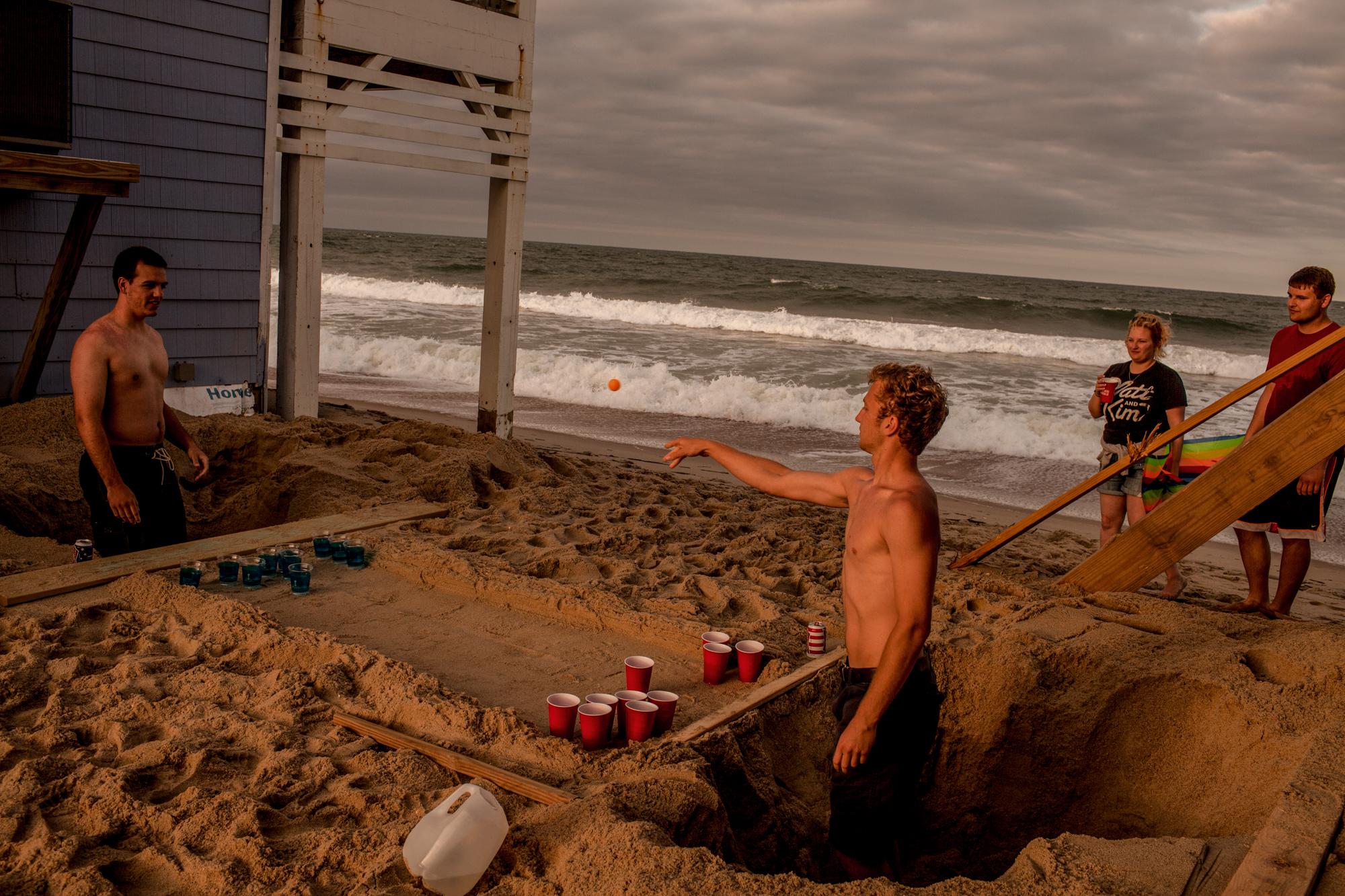
Friends from Ohio play a modified drinking game in holes they dug outside an oceanfront vacation rental property in Rodanthe, North Carolina. The Outer Banks brings in nearly $1 billion a year through tourism-related spending, the bulk of the season lasting just four months, from June through September.

Each year, the small fishing community of Stumpy Point hosts an oyster feast for residents and visitors. Along the Pamlico Sound and bordering the Alligator River National Wildlife Refuge, around 243 people call Stumpy Point their home. Surrounded by wetlands, swamps and maritime forest, Stumpy Point is an inland fishing community protected by the presence of the Outer Banks barrier islands. The surrounding habitat is host to several endangered species and a thriving habitat threatened by encroaching salt water.
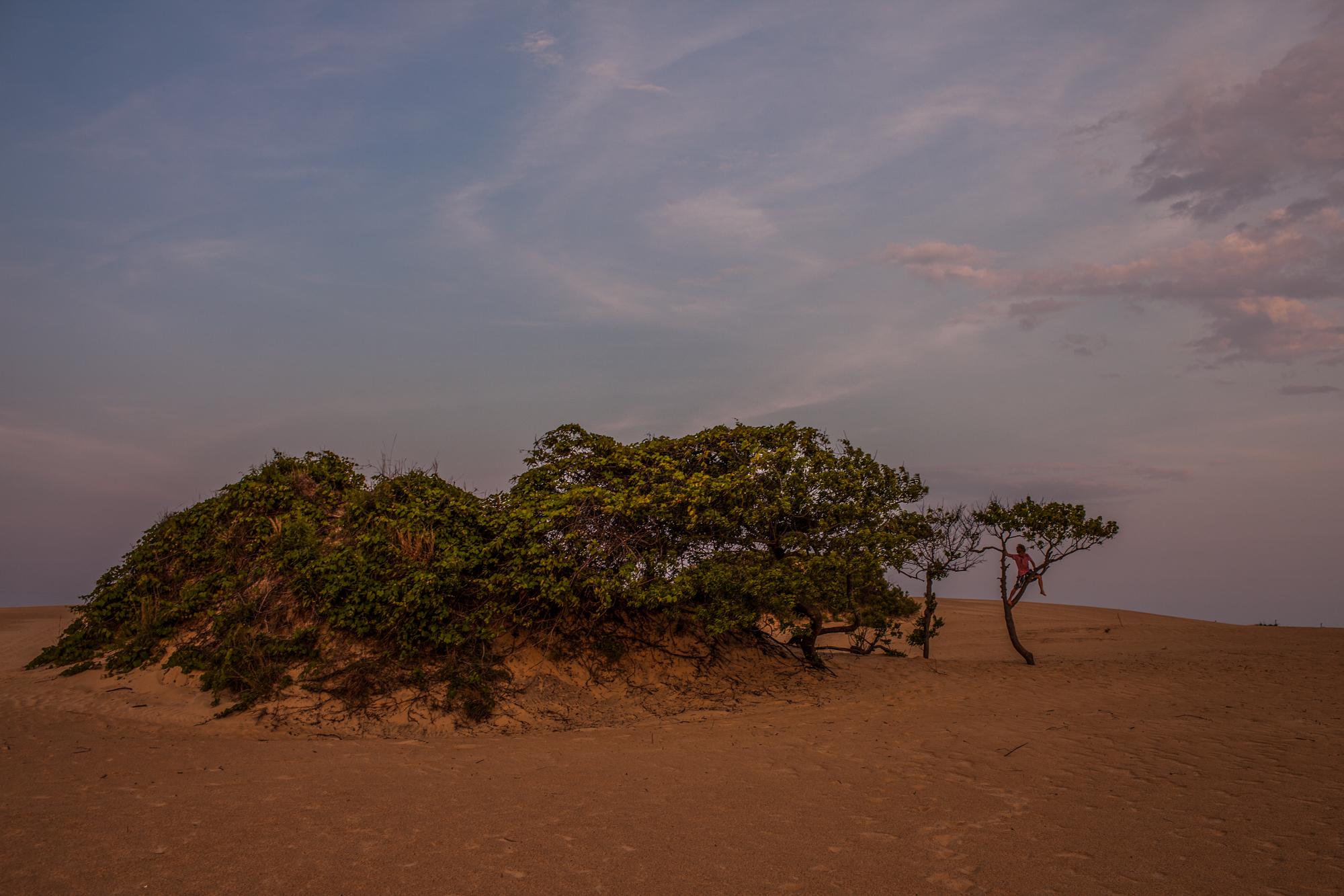
A network of sand dunes spans the Cape Hatteras National Seashore in Frisco, North Carolina. The dunes, in part, act as a natural barrier between the man-made structures and the often unforgiving Atlantic Ocean. In 2010 state officials said the ocean could be 39 inches higher, all but eliminating the Outer Banks and the coastal piedmont area they protect. While other cities across the country embraced the data, lobbyists for the real estate industry and developers along the Outer Banks set out to not only attack the ruling, but question global warming and climate change as a whole. When the moratorium lifts, the state will revisit the issue focused on the next 30 years which has a significantly less predicted rate of no more than 10 inches.

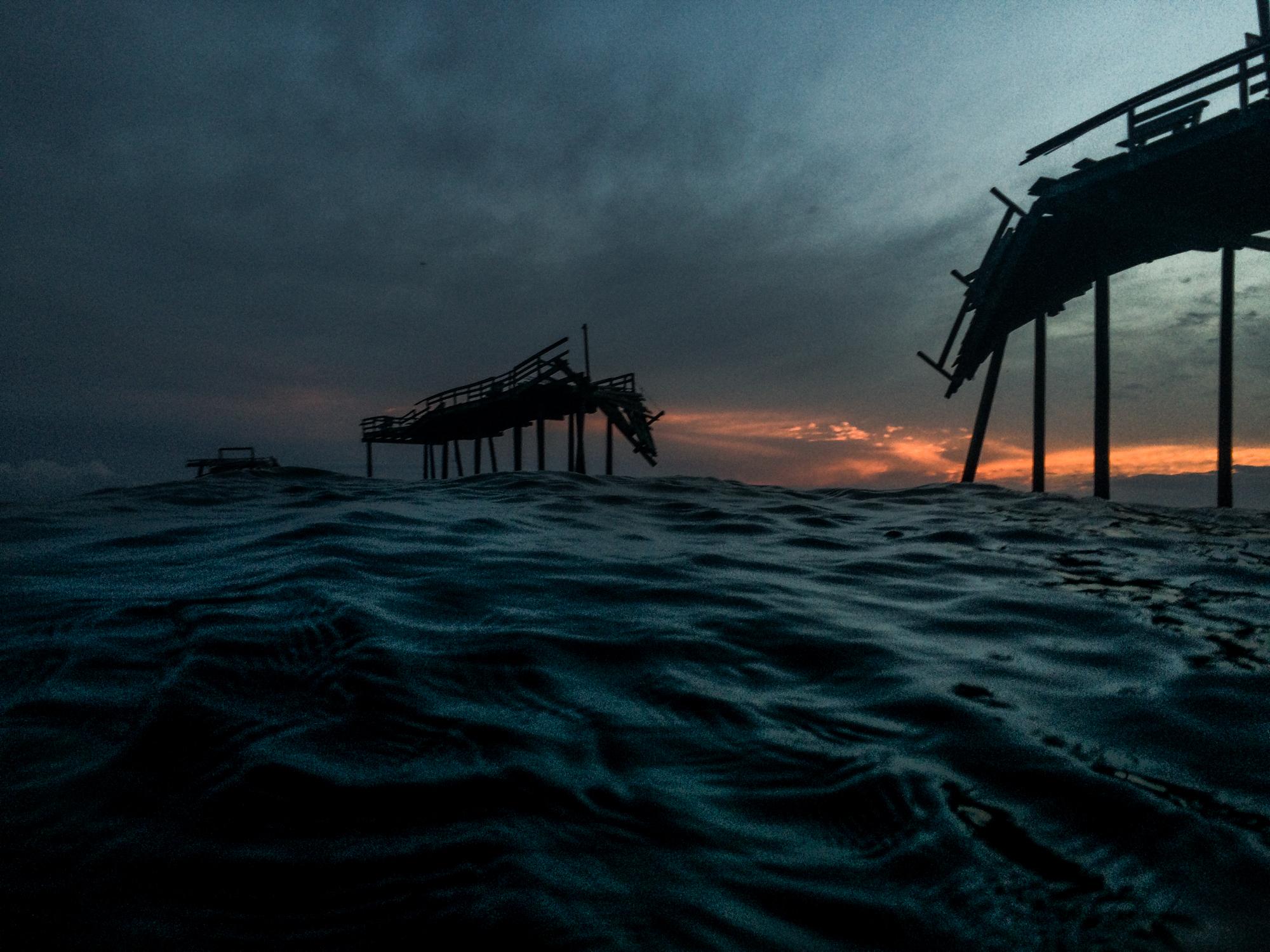
Originally built 20 feet wide and 500 feet long, the Cape Hatteras Fishing Pier opened to the public in 1962. After years of damaging storms, the pier, known locally as Frisco Pier, was finally closed to the public in 2010 following Hurricane Earl, becoming a visual attraction for its remaining sections.
Shifting Sands

John Tully
Photojournalist
based in New Hampshire, USA
Public Story
Shifting Sands
139