1 of 27
© 2021 Aaron Vincent Elkaim
A fire lit by a rancher burns on the side of the BR-163 highway north of Novo Progresso, Para, Brazil.
2 of 27
© 2021 Aaron Vincent Elkaim
Millitary police and Agents with ICMBio, assigned to protect conservation areas around Novo Progresso, one of the worst deforestation zones in Brazil. The team, which has one agent per one million hectares of forest, uses satellite imaging to track new forest clearing and fires. Here on an operation in the Jamanxim National Forest, where an area had been recently cleared by ranchers.
3 of 27
© 2021 Aaron Vincent Elkaim
An illegal road, probably used for logging, runs through protected forest in the Amazon Rainforest in Para, state, Brazil.
4 of 27
© 2021 Aaron Vincent Elkaim
Fazenda Esperança ranch near SInop owned by Invaldo Weiss, 61. The ranch has 2,700 head of cattle. He raised the money to build his ranch by using heavy equipment to cut down the rainforest for other farmers.
5 of 27
© 2021 Aaron Vincent Elkaim
Deforestation is seen from the air near the BR-163 near Itaituba, Para state, Brazil.
6 of 27
© 2021 Aaron Vincent Elkaim
Farm workers spray fields off the side of the Br-163 in Mato Grosso state, Brazil.
7 of 27
© 2021 Aaron Vincent Elkaim
A worker fills trucks with corn kernals at Japuíra soy farm in Nova Mutum, Mato Grosso state. The BR-163 is a major soy corridor.
8 of 27
© 2021 Aaron Vincent Elkaim
Invaldo Weiss, 61, on his Fazenda Esperança ranch near SInop, where he has 2,700 head of cattle. He raised the money to build his ranch by using heavy equipment to cut down the rainforest for other farmers.
9 of 27
© 2021 Aaron Vincent Elkaim
Ranchers skin a cow near the town of Sinop in Mato Grosso State.
10 of 27
© 2021 Aaron Vincent Elkaim
Deforestation is seen from the air near the BR-163 near Itaituba, Para state, Brazil.
11 of 27
© 2021 Aaron Vincent Elkaim
Agents with ICMBio, assigned to protect conservation areas around Novo Progresso, one of the worst deforestation zones in Brazil. The team, which has one agent per one million hectares of forest, uses satellite imaging to track new forest clearing and fires. Here they speak to a local rancher while on an operation in the Jamanxim National Forest, where an area had been recently cleared by ranchers.
12 of 27
© 2021 Aaron Vincent Elkaim
Agents with ICMBio, assigned to protect conservation areas around Novo Progresso, one of the worst deforestation zones in Brazil. The team, which has one agent per one million hectares of forest, uses satellite imaging to track new forest clearing and fires. On an operation in the Jamanxim National Forest they charge a gourp of garimpeiros or illegal artisnal Gold miners they caught while investigating illegal logging and clearing.
13 of 27
© 2021 Aaron Vincent Elkaim
14 of 27
© 2021 Aaron Vincent Elkaim
A garimpeiro or illegal gold miner hugs his wife as he's apprehended by the ICMBio government agents
15 of 27
© 2021 Aaron Vincent Elkaim
Smoke from a year of record fires covers protected Amazon Rainforest near Itaituba in Para, state, Brazil.
16 of 27
© 2021 Aaron Vincent Elkaim
Rosineide Savi Garcia, 40, runs a reforestation project on 8 hectares inside her property in Novo Horizonte, Nova Guarita. She has been replanting trees for 17 years, more than 10,000 of them, she says.
17 of 27
© 2021 Aaron Vincent Elkaim
The seed of a tree called a monkey's comb is held by the daughter of Rosineide Savi Garcia, 40, who runs a reforestation project on 8 hectares inside her property in Novo Horizonte, Nova Guarita. She has been replanting trees for 17 years, more than 10,000 of them, she says.
18 of 27
© 2021 Aaron Vincent Elkaim
A young Munduruku man from the Village of Sawre Muybu eats a local fruit near the Tapajos River. The Munuduku are fighting to protect their land from hydroelectric development, deforestation and illegal gold mining.
19 of 27
© 2021 Aaron Vincent Elkaim
Two men from the community of Montanha-Mangabal head home after a visit to Sawre Muybu. The community is made up of beiradeiros —riverside peasant farmers and traditional fishermen - who have partnered with their once enemies the Munduruku to fight and protect their land from hydroelectric development, deforestation and illegal gold mining.
20 of 27
© 2021 Aaron Vincent Elkaim
Munduruku kids swim in a stream running nex to their village of Sawre Muybu on Tapajos River. The Munuduku are fighting to protect their land from hydroelectric development, deforestation and illegal gold mining.
21 of 27
© 2021 Aaron Vincent Elkaim
A saw mill along the BR-163 near Itaituba, Para state, Brazil.
22 of 27
© 2021 Aaron Vincent Elkaim
Truck drivers have a meal at a truckstop off the side of the BR-163 in Para state, Brazil.
23 of 27
© 2021 Aaron Vincent Elkaim
The ferry to Miritaituba, a major shipping port for soy and grain along the Tapajos River.
24 of 27
© 2021 Aaron Vincent Elkaim
Smoke hangs over Novo Progresso in the early moring in Para, State, Brazil.
25 of 27
© 2021 Aaron Vincent Elkaim
A morning market with the Cargill soybean terminal seen in the background in the city of Santarem at the end of the BR-163 in Para state, Brazil. The terminal was original built without proper environmental licensing and has driven deforestation and soy production in the surrounding Amazon, though the terminal was built primarily to export soy from Mato Grosso.
26 of 27
© 2021 Aaron Vincent Elkaim
A Munduruku girl sits by a fire in the village of Praia do Mangue outside Itaituba, Para state, Brazil.
27 of 27
© 2021 Aaron Vincent Elkaim
A fire lit by a rancher burns on the side of the BR-163 highway north of Novo Progresso, Para, Brazil.
Public Story
The Road - The Globe and Mail
Credits:
aaron vincent elkaim
Date of Work:
09/14/17 - 09/30/17
Updated: 06/03/18
<< BACK
THE ROAD
"The story of this road, the BR-163, is in many ways the story of Brazil’s relationship with the rainforest.
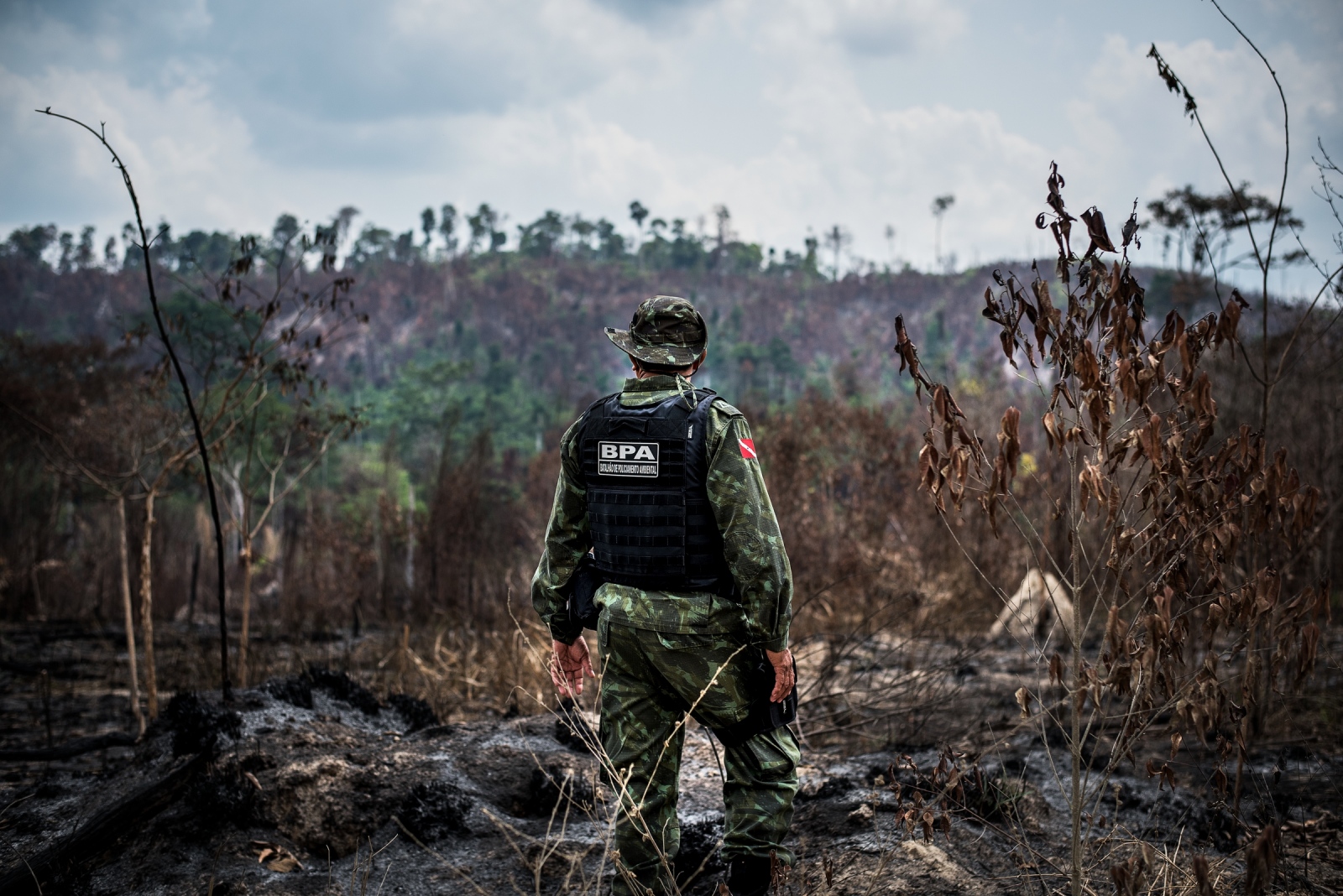
When construction of the highway began back in 1972, the country was ruled by a dictatorship that viewed the Amazon as a risk: all that unoccupied territory, ripe for the taking by an enemy. And so the military rulers devised a policy, ocupar para não entregar – occupy so we don’t lose it – that aimed to move more people into the forest, fast. In the process of marking Brazilian ownership of the Amazon, the military rulers were also able to achieve another critical goal: the resettlement of poor, landless people who were then swelling the cities of Rio de Janeiro and São Paulo searching for work. This road, the BR-163, was a key north-south pole in that expansion.
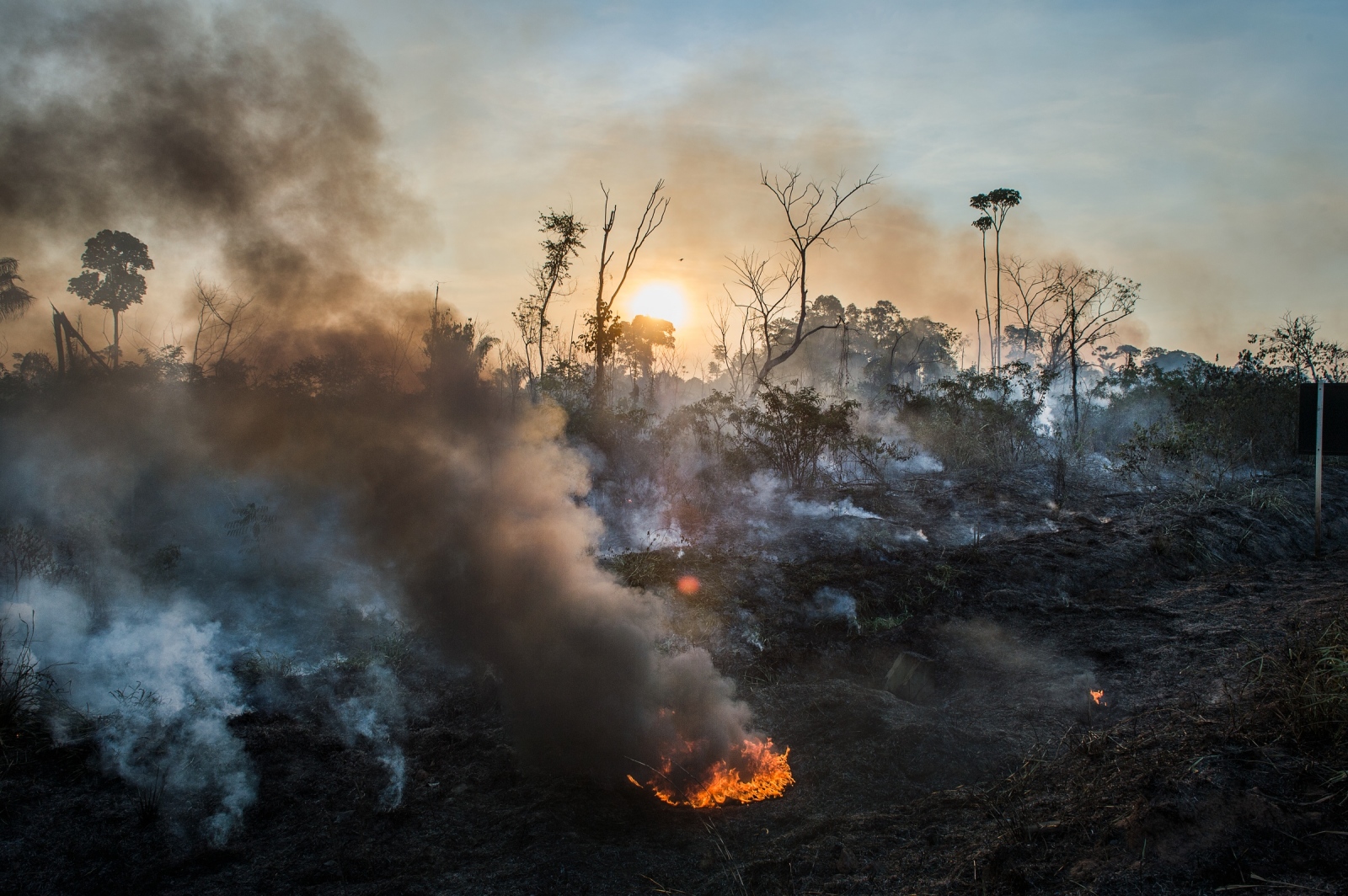
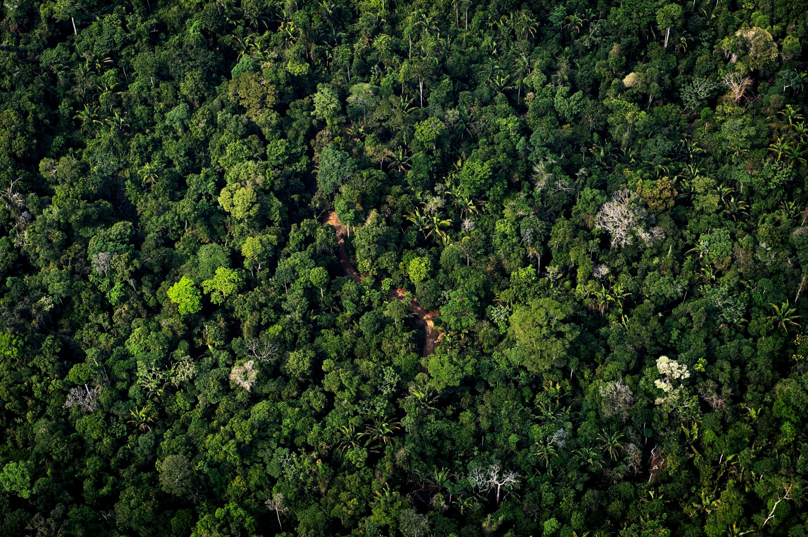
Today, it runs from Cuiabá, in the heart of the grain basket, to Santarém, a muggy port city on the Amazon River. As it snakes north, it cuts a path not only through the country itself, but through Brazil’s conflicting ambitions: to transform itself into a first-world economy, on the one hand, and on the other, to protect and preserve what is left of an ecosystem that recycles a fifth of the world’s rainfall, holds 150 billion tonnes of stored carbon, and is home to 15 per cent of all the species on Earth." - Stephanie Nolan The Globe and Mail
THE GLOBE AND MAIL
Also by Aaron Vincent Elkaim —